
Introduction: Listening to an Invisible Threat
In the pristine environment of the Galápagos Islands, sound plays a critical ecological role. Birds use it to communicate, marine species depend on it to navigate, and scientists interpret it to understand environmental health. Yet, the increasing expansion of urban zones, tourism, and maritime traffic has brought an invisible pollutant: noise.
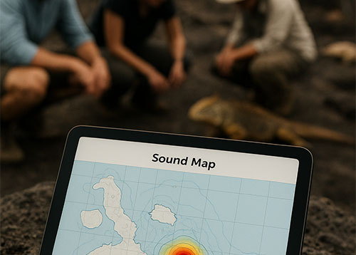
The Noise Map of Galápagos, developed by the Galápagos Acoustic Office (OAG), is the first comprehensive scientific effort to measure, model, and manage environmental noise in the archipelago. Using advanced software such as CadnaA (Datakustik, Germany) and laboratory calibrations certified under ISO 17025, this initiative transforms acoustic data into a legal and management tool for conservation.
1. The Science Behind the Noise Map
The Noise Map is not merely a graphic display of decibels—it’s a complex acoustic model that integrates physical, environmental, and social data.
The methodology involves:
- Systematic field measurements using precision sound level meters calibrated to ISO 17025 standards.
- Geospatial modeling with CadnaA to simulate noise propagation in 3D across urban and coastal zones.
- Environmental zoning, identifying sensitive areas such as breeding grounds, nesting sites, and coastal communities.
The combination of these data layers allows OAG to visualize how human activities—vehicular traffic, generators, ports, and tourism—interfere with the natural soundscape of Galápagos.
2. Why Noise Pollution Matters in Island Ecosystems
Noise pollution alters animal behavior and ecosystem dynamics. Studies show that chronic exposure to high sound levels:
- Causes stress and displacement in seabirds and iguanas.
- Interferes with echolocation and communication in marine mammals.
- Reduces feeding efficiency and reproductive success in several fish and bird species.
In Galápagos, where each species plays a critical ecological role, even small acoustic disturbances can cascade into significant ecosystem impacts.
By quantifying and mapping noise exposure, OAG provides data that help policymakers prioritize conservation zones and noise mitigation strategies.
3. Methodology and Technical Framework
The Noise Map methodology is based on international acoustic standards and scientific transparency.
- Data Collection – Measurements are performed at different times of day to capture variations in sound levels. Portable and fixed monitoring devices record equivalent continuous levels (Leq), maximum peaks (Lmax), and frequency spectra.
- Calibration and Validation – Instruments and data undergo laboratory verification under ISO 17025 accreditation to ensure accuracy.
- Modeling and Simulation – Using CadnaA, acoustic engineers simulate noise propagation considering terrain, building geometry, vegetation, and meteorological conditions.
- Verification and Mapping – Modeled data are validated with field measurements and represented through color-coded maps showing safe, moderate, and critical noise zones.
The result is a dynamic 3D model that can be updated as new data are collected, ensuring a living system of environmental monitoring.
4. From Data to Decision-Making
The ultimate goal of the Noise Map is to inform and guide public policy.
- Municipal authorities use it to establish urban zoning and regulate activities that exceed permissible noise levels.
- Environmental agencies integrate the data into biodiversity management plans.
- Tourism operators apply findings to adopt quieter, more sustainable practices.
By linking science and governance, the OAG enables the creation of evidence-based regulations—a rare but essential step for small island systems.
5. Terrestrial and Marine Monitoring Stations
Parallel to the mapping project, OAG has implemented terrestrial and marine acoustic monitoring stations.
- Terrestrial Stations are installed in Baltra, Puerto Ayora, Charles Darwin Avenue, and Tortuga Bay. They continuously record sound levels, transmitting data in real time.
- Marine Stations (in progress) will consist of hydrophone buoys capable of detecting underwater sound events such as ship collisions, propeller noise, and marine fauna communication patterns.
These systems allow scientists and authorities to compare daily sound fluctuations with biological observations, creating one of the first acoustic biodiversity indicators in the region.
6. Community Education and Public Engagement
A vital part of OAG’s work is education and community involvement.
Noise is often underestimated because it’s invisible. Through talks, workshops, and training programs, the organization helps residents, schools, and tourism operators recognize the importance of acoustic balance.
The Environmental Education Program provides educational materials, interactive guides, and citizen science initiatives that allow locals to participate in noise monitoring.
This inclusive approach strengthens the collective responsibility of Galápagos inhabitants toward maintaining their unique environment.
7. Transparency and Accessibility
OAG ensures that the Noise Map and related information are openly accessible.
- Interactive versions of the map allow users to explore real-time data.
- Technical and educational reports can be downloaded from the OAG platform.
- Annual summaries provide detailed descriptions of progress, funding sources, and partnerships.
This transparency not only builds trust but also encourages scientific collaboration and continuous improvement of the monitoring system.
8. Challenges and Future Perspectives
Developing a Noise Map for a World Heritage Site presents technical and logistical challenges: limited infrastructure, variable environmental conditions, and restricted access to sensitive habitats.
However, the success of the initial phases in Santa Cruz and Baltra sets the foundation for expansion to other islands such as San Cristóbal, Isabela, and Floreana.
Future plans include:
- Integrating AI-based analysis to automate sound classification.
- Expanding marine acoustic monitoring networks.
- Collaborating with global conservation organizations to compare island soundscapes.
The long-term vision is to establish Galápagos as a global model of acoustic conservation—a benchmark for other fragile ecosystems.
9. The Role of Technology Partners
Projects of this scale require cross-sector collaboration. The support of Nexon Digital Tech provides the digital infrastructure for data management and visualization, while partnerships with academic institutions ensure methodological rigor.
This synergy between science and technology enables the project to deliver accurate, actionable, and accessible data to decision-makers and the public.
10. A Global Message from a Local Effort
The Galápagos Islands symbolize the delicate balance between nature and human activity. By mapping sound, OAG not only monitors environmental noise but also redefines how conservation is measured.
Sound becomes a diagnostic tool—an indicator of ecological health and a bridge between science and society.
The Noise Map of Galápagos represents hope: a vision where technology and community action converge to ensure that future generations inherit not just the beauty of the islands, but their true natural silence.
Conclusion: Toward an Acoustically Sustainable Future
The Noise Map is more than an environmental project; it is an ethical commitment to the preservation of life in one of Earth’s most emblematic ecosystems.
Through accurate data, technological innovation, and citizen participation, the Galápagos Acoustic Office sets a new standard for environmental management.
Protecting sound is protecting life—and in the Galápagos, every decibel counts.
